
North Plainfield ZIP Coverage
North Plainfield is served through shared postal geography. Official Borough material uses 07060 and 07063, while New Jersey legislative material identifies 07060, 07062, and 07063 as shared North Plainfield and Plainfield ZIP areas. The table records what the reviewed local and state material supports. It does not draw postal boundary lines or assign every street to a municipality. Use the full-address postal result and the parcel municipality together before connecting an address to a local record.
| Postal label | Area in official shared-ZIP material | Post office | Verification note |
|---|---|---|---|
| 07060 | North Plainfield and Plainfield shared area; used in official North Plainfield addresses | Not identified in reviewed official sources | May point to Plainfield, Union County; confirm with USPS and the parcel municipality |
| 07062 | North Plainfield and Plainfield shared-ZIP area identified by New Jersey legislative material | Not identified in reviewed official sources | A ZIP does not establish Somerset County rather than Union County |
| 07063 | North Plainfield and Plainfield shared area in official state and local material | Not identified in reviewed official sources | Use the postal result and parcel query because shared names can cause misdelivery |
Primary local post-office names and exact ZIP boundary polygons were not located in the official sources reviewed. The absence is important. A postal directory should not replace that missing evidence with a guessed station name or a map line that has not been verified.
North Plainfield USPS ZIP Check
The USPS address lookup is the address-level authority for the postal result. The reviewed source material confirms a full-address or city, state, and ZIP route, but it did not capture the live form's exact runtime fields or a North Plainfield result. Enter the whole North Plainfield street address, preserve the result and date, and then compare that result with the Borough and county parcel information. A city name by itself is not a safe substitute.
The official USPS lookup is shown below because the page is dynamic and the live result must be checked for the actual address being researched.
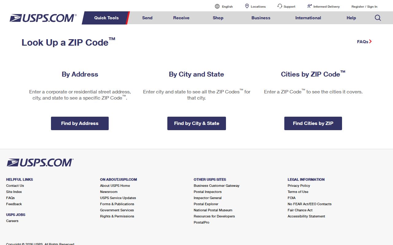
The captured USPS screen confirms the official lookup route, not a permanent result for any one address. Record a fresh result when the postal ZIP affects a property, court, or historical-directory search.
North Plainfield ZIP Search Fields
Postal and parcel tools work at different levels. USPS validates a mailing address. The county parcel viewer identifies a legal and assessment geography. The state parcel resource can search address, county, municipality, block, and lot. None of the reviewed property sources verified ZIP as a parcel-search filter. The table makes that difference visible so a searcher does not mistake a postal result for a resident or owner index.
| Tool | Verified inputs or route | What it returns | Postal limit |
|---|---|---|---|
| USPS lookup | Full address or dynamic city/state/ZIP route | Postal validation or result | Exact live fields and a local result were not captured |
| Somerset County Tax Parcel Viewer | Address Search; Municipality, Block, Lot, Qcode, Property Class Category | Parcel map and results table | It is not a ZIP-driven resident search |
| Somerset assessment hub | Owner, location, block, and lot property search; live labels not captured | Annual tax-property context | No verified ZIP filter was located |
| New Jersey parcel resource | Address, county, municipality, block, and lot | Parcel search | Hosted owner data can be redacted under Daniel's Law |
| Directory archive | Historical street or person address by year and title | Dated printed entry | Postal labels and municipality sections can differ |
The New Jersey GIS parcel resource warns that hosted parcel and tax-list owner names are redacted under Daniel's Law, and county parcels may not edge-match across county boundaries. That warning reinforces the need to retain municipality and county with the postal result.
Finding North Plainfield By ZIP
A ZIP can organize a search, but North Plainfield's shared postal areas require an address-first sequence. The reviewed sources do not establish a general resident directory filtered by ZIP. Instead, use ZIP as one verification field, then move to municipality, county, parcel identifiers, and dated records. The voter status route is an individual check, while the County voter-list request has a defined municipal or voting-district scope and a certified political purpose.
- Enter the full street address in USPS and save the postal result with the date checked.
- Confirm that the municipal field is North Plainfield Borough and the county field is Somerset County.
- Locate the address in the County Parcel Viewer by selecting the municipality before using block, lot, or Qcode.
- Use Acclaim's legal description and a dated directory title to reconcile an older address variant when necessary.
- For voter information, use the state status lookup for an individual or request the correctly scoped county list under its stated purpose and limits.
Once the postal check has narrowed an address to the right Borough and county, the North Plainfield street directory gives the fuller street-by-street parcel and deed workflow.
North Plainfield Postal Routing
Federal filing geography makes the shared-ZIP mismatch concrete. The District of New Jersey shared-ZIP table routes Plainfield and Union County shared ZIPs to Newark, while North Plainfield and Somerset County shared ZIPs route to Trenton. The table is a court-routing document, not a postal boundary map. Its value here is as a quality-control reminder that the same ZIP can lead to two jurisdictions.
When a court, agency, property, or legal-record destination depends on location, require both the municipality and county. Do not use the federal routing table to redraw postal boundaries. Likewise, do not use a postal response to choose a court or parcel jurisdiction without the additional place fields.
North Plainfield ZIP Records
A useful address citation saves the pieces that each source actually establishes. Keep the full ZIP, USPS result date, North Plainfield Borough, Somerset County, and the parcel block and lot when available. Add the assessment tax year or the deed's legal description and instrument details only from the record viewed. This structure lets a later reader distinguish a postal fact from a property or recorded-document fact.
For example, a citation can read: ZIP 07060; USPS result checked on the search date; municipality North Plainfield Borough; county Somerset; parcel block and lot as shown in the County viewer. Add a directory's printed title, year, section, and page separately. The original wording should remain intact when the historic source says Plainfield or omits a ZIP.
Note: Keep postal, municipal, county, parcel, and historical-directory fields separate instead of silently replacing one with another.
North Plainfield ZIP Map Grid
The official Borough street map adds a geography check after USPS and parcel work. It covers the Borough's 2.9-mile map grid and labels Vermeule Cemetery at B2 and Brook Avenue Cemetery around D7 and D8. Those labels help orient an address when a duplicated street name or historic directory entry is hard to place. They do not establish a ZIP boundary or identify a current household.
North Plainfield sits at the base of the Watchung Mountains. Older material may use names such as Blue Hills, Vermeule, Brookside, or Watchung. Treat those words as leads for a date-and-address comparison. The map grid, municipality, county, ZIP, and parcel details together offer a more reliable geographic record than a postal city alone.
North Plainfield ZIP Boundaries
ZIP boundaries and city limits serve different systems. A postal ZIP supports delivery routing. A municipality and county determine the local government and parcel jurisdiction. A tax map and legal description identify land. The same address can appear with a postal city in one source, North Plainfield Borough in another, and no ZIP in an older deed. When the records cannot be reconciled, retain the original spelling and mark the municipality unresolved rather than forcing a match.
- ZIP and ZIP+4
- A ZIP identifies a postal delivery area; ZIP+4 adds a more specific delivery segment and does not replace the municipal field.
- PO-box ZIP
- A ZIP assigned for post-office boxes rather than a geographic delivery area. No North Plainfield PO-box ZIP was verified in the reviewed sources.
- Unique ZIP
- A ZIP used for a single institution or organization. No North Plainfield unique ZIP was verified in the reviewed sources.
- Carrier route
- A delivery sequence within postal operations, not a legal parcel boundary or a household roster.
Boundary warning. Do not infer a person, property owner, or legal jurisdiction from a ZIP alone. Respect Daniel's Law redactions, protected addresses, and the distinct purpose limits that apply to voter information.
North Plainfield ZIP Address Labels
Historical records add another layer to the postal check. Plainfield Public Library's directory collection spans 1870 through 1982 with gaps. Its 1891 title explicitly combines the City of Plainfield and Borough of North Plainfield, while the 1982 volume is described as a large combined volume. A historic address may use Plainfield as the printed place name even when the later parcel is in North Plainfield Borough. Preserve the title and section before drawing a conclusion.
County deed books and early land records can reach into the eighteenth and nineteenth centuries, while the online County Clerk index includes the pre-1977 Alpha Index and later indexed material. Historic map footprints, modern street numbers, and postal labels may not align. Start with the full address and present jurisdiction, then record every older label as evidence rather than rewriting it into a modern postal-directory entry.